Notes from Windward
In and around Klickitat County
a celebration of the mid-Columbia region
Mt. Hood from Laurel Hill
on the old Barlow trail
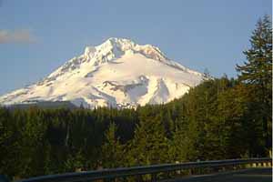 |
Heading north on Highway 35, south of the mountain, you're treated by this remarkable close up view of Mt. Hood. It's said to be the second most climbed volcano in the world, second only to Mt. Fuji. This view gives you an idea why.
From Lyle, looking west
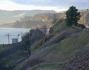 |
The Klickitat enters the Columbia here at Lyle.
Sunset over the town of Hood River
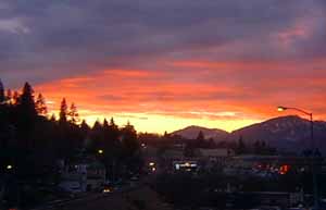 |
The town of Hood River forms the western gateway to Klickitat county.
Mt. Hood overlooks Hood River
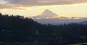 |
This shot was taken from halfway across the Hood River bridge looking south.
Highway 14
midway between Lyle and Bingen
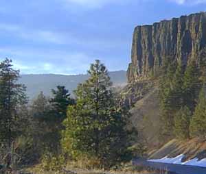 |
A view from the rest stop, halfway between Bingen and Lyle.
a micro-rainbow
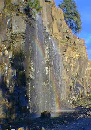 |
During the rainy season, the gorge is decorated with a thousand waterfalls. Some like Multnomath Falls are high and majestic, but my favorite is this little micro-rainbow waterfall that stands close by Highway 14 welcome visitors to the mid-Columbia. The south side of the Columbia has Interstate 84, and most people take that route for the speed and convenience it offers. The north side is slower, but so much more scenic.
Winter fog shrouds the Klickitat River
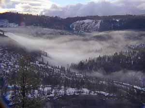 |
This view from Wahkiacus Heights overlooks the Klickitat River around mile post 18. This is where Highway 142 veers off to the east while the river continues north towards Mt. Adams. The Klickitat is one of the longest wild rivers in Washington state.
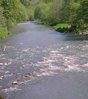
Spring on the Klickitat
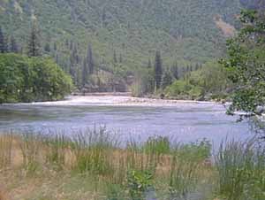 |
Around mile post seven, the Klickitat slows down and seems to rest. That's good because it's not too far ahead that the cataract starts. Soon, the river narrows down and races through a canyon that in places is barely fifteen feet wide.
The Klickitat is classified as a wild river. At places like this on the river, it's easy to forget that.
Tamara (age 7) and Bronte
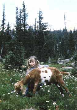 |
This is from a hike up the side of Mt. Adams to beautiful Bird Creek Meadows. Bronte is was the kid we took to the Mensa National Gathering in Anaheim.
The Little Klickitat River
where it joins the Klickitat
 |
Highway 142 runs north from Lyle along the Klickitat river for 18 miles to where the Klickitat and Little Klickitat join.
Looking down on the
Little Klickitat
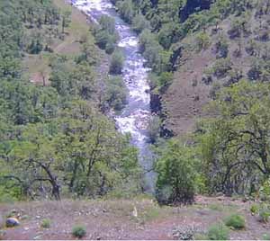 |
From there, the road narrows to one paved lane and then winds its way up the side of the canyon to return to the terrace some 800 feet above.
Notes from Windward
----
The Windward Home Page