|
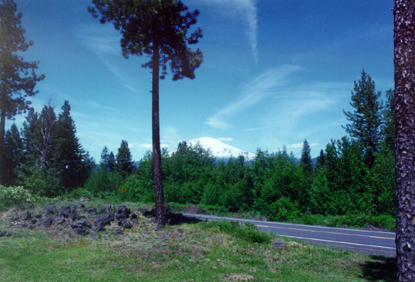
Mount Adams, standing high at 12,236 feet, is the second highest
snowcap peak in the Cascade Range of Washington and Oregon.
From a standpoint of bulk, it is by far the largest as it
dominates the scene in south central Washington State.
This handsome Trout Lake Valley, extending
southward from Mount Adams bulk, is bisected by the wild and
Scenic White Salmon River that connects with the Columbia
George National Scenic Area some 25 miles to the south.
This scenic valley was not settled by Euro-Americans
until the 1880's. The tumbling White Salmon River, draining
Mount Adams glaciers, proved a barrier rather than an access
to early settlers. It is an unusually turbulent river in a
deep channel carved through lava flows. In recent years it
has become one of the Northwest's most accessible and most
favored rivers for white water rafting and kayaking.
The Mount Adams foothills lie mainly in the
vast Gifford Pinchot National Forest. The Mount Adams Ranger
District headquarters in Trout Lake. One feature of this vast
reserve is the world's most extensive huckleberry fields that
attract thousands of visitors each year. The well-known spotted
owl controversy has greatly curtailed logging in the area
but it remains a vast, exciting playground for the public
- all tributary to the Trout Lake Valley.
The volcanism that formed the mountain produced
a profusion of lava tube caves around its base. It is a Mecca
for spelunkers.
Though no major ski area has developed on
Mount Adams, its foothills are a winter attraction to the
snowmobile and cross-country ski crowds who find miles of
groomed trails - and more miles of pristine snow country.
The valley, with its lake and tumbling streams,
has attracted not only visitors but many new residents in
recent years. It is a spectacular upland valley that is really
just becoming "discovered".
|